The challenge: Water resources in many UK river catchments are over-allocated, leading to conflict over water and restrictions on some uses during drought events. Pressures on scarce freshwater supplies will likely be exacerbated in future decades as a result of rising demand from population growth, along with increases in the frequency and intensity of droughts due to climate change. To address these challenges, new water supply infrastructure is being planned by many water companies, supported by regional and national model-assisted water supply planning studies. However, such ‘water supply infrastructure’ models lack sufficient detail to analyse the effects of catchment management measures and their interactions with built infrastructure, such as changing land or agricultural management practices and new policies for water allocation and demand management (e.g. abstraction license reform, water trading, payment for ecosystem services via land management contracts, etc.). A new approach to water resource management is needed in UK water scarce catchments, which utilises custom-designed portfolios of climate-resilient infrastructure and policy measures to support sustainable management of water for businesses and communities, the environment, and agriculture.
Aim: Enable decision-relevant understanding of how new catchment scale assets (e.g. water supply infrastructure), landscapes (e.g. land management and agricultural production systems), and policies (e.g. water sharing and trading schemes) can increase resilience and climate change adaptability of water resource systems, enabling competing demands of limited water resources to be balanced cost-effectively while minimising impacts on the environmental and freshwater ecosystems.
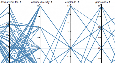
Methods: Connect an extended version (with water trading) of the UK’s leading open-source water resource management model (used by 11 water companies) to open-source distributed hydrologic, land-use and agricultural production models. This novel proof of concept interconnected land & water biophysical hydro-economic simulator will be linked to decision analysis under uncertainty approaches, such as multi-criteria trade-off optimisation, to optimise the adaptive adoption of complex portfolios of water-land management interventions in UK catchments. A web-based catchment visualisation tool will enable to toggle back and forth between a map-based catchment intervention portfolio and trading view, and a multi-metric performance dashboard so that stakeholders and decision-makers can assess portfolios of interventions and pre-approved water trades.
Case study: The Cam and Ely Ouse is one of the four pilot catchments identified by the Environment Agency (EA) to trial abstraction reform.
Impact: By designing and implementing a proof-of-concept management approach based on integrated land-water simulation, optimised trade-off based climate change decision-making, and interactive visualisation the project aims to enable a transformation of how catchment level planning (investments, water policies) decisions are made. This could improve the UK’s land-water climate resilience, minimising the economic, social and environmental cost of water scarcity under climate change. Given the need to design new environmental conservation subsidies for UK farmers (post-CAP), the proposed outputs will provide an objective framework to understand how different land and agricultural management changes beneficially (or not) impact catchment water outcomes. The approach will be as general as possible to enable subsequent wider application (e.g. to operational drought management (real time water allocation), flood protection, etc.).
Publications
- Harou, J. J. 2019. Towards a national water resources planning framework in England. Proceedings of the Institution of Civil Engineers – Water Management. 172:6, 271-272.
- J.E. Tomlinson, J.H. Arnott, J.J. Harou. 2020. A water resource simulator in Python. Environmental Modelling & Software. Volume 126, 104635.
- Marzano, R., Rougé, C., Garrone, P., et al. 2020. Response of residential water demand to dynamic pricing: Evidence from an online experiment. Water Resources and Economics, Volume 32, 100169.
- Erfani, T., Pachos, K., Harou, J. J. 2020. Decision-dependent uncertainty in adaptive real-options water resource planning. Advances in Water Resources. Volume 136, 103490.

